
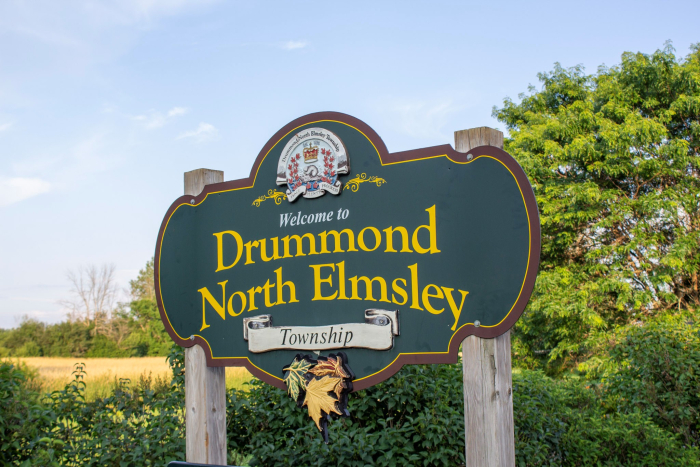
DNE (623)

Community Highlights
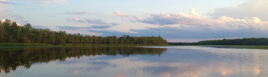
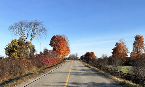
We have so many great places to come and see and so many things to do. Take a look around, enjoy the beautiful scenery and many historical sites around the Township such as the Tay Canal, or perhaps look up your own history at Archives Lanark. Not your cup of tea? Try out the Port Elmsley Drive-In, one of only a few in Ontario.
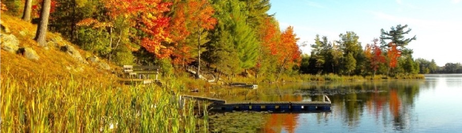
Looking for a day outside? Why not enjoy a gorgeous float down one of our many waterways, walk along the trails in Rideau Ferry or have a picnic along one of the waterways.
Take a look around and find what sparks your interest, there’s a lot to do and a lot to see...
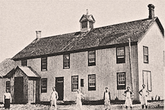
 The Archives, located in the former Drummond Township office in the hamlet of Drummond Centre, is an independent non-profit organization which provides a wealth of vital information dating from the 1850’s including land deeds, cemetery listings, census records, records of baptisms and marriages and newspaper collections. Archives Lanark has proved an invaluable resource for patrons across North America researching family roots as well as local families, church groups, school children and genealogists.
For more information visit their website
 Visit the home of Balderson Cheese. Established in 1881, Balderson Cheese has become world famous. Discover this quaint country hamlet with fantastic shops and don’t forget to treat yourself to an ice cream!
For more information visit their website
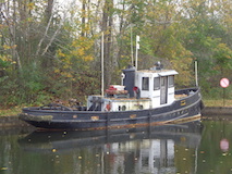
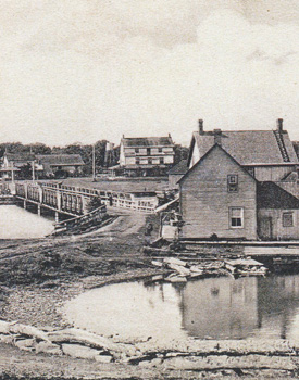
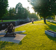 Forming part of the Rideau Canal National Historic Site, these locks serve to connect the Town of Perth, through the Tay River, to the Rideau System. The original Tay Canal was built along the length of the Tay ending with a series of locks near Port Elmsley. It fell in disrepair and was dismantled in 1865, although traces remain. The new canal was finally completed in 1891 connecting Perth to the Rideau System through a new canal ending at Beveridge Bay. The facility contains two locks as well as an on-site exhibit, boat launch and short trail. The scenic trip along the Tay is a popular day trip for Rideau Canal travelers.
For more information visit their website
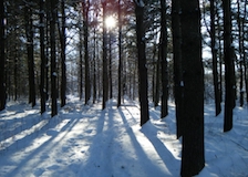
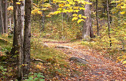 A national network of trails connecting every province and most major cities, the multi-purpose trails provide opportunities for hiking bicycling and snowmobiling and when complete, the network will become part of the longest trail in the world. This trail passes through Drummond Ward along Concession 8A, Prestonvale Road, Dunlop Side Road and up to Ferguson’s Falls.
A multipurpose trail connecting Ottawa and Kingston allows hikers, cross-country skiers and snowshoers the opportunity to travel the length of the Rideau Canal. The trail, with a total length of 387 kilometers, is maintained by the Rideau Trail Association and passes through the southern portion of North Elmsley. The Association holds regular hikes for members and guests.
For more information visit The Great Trail website or the Alltrails website
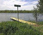 The Township’s Public Works Department recently announced the installation of a public dock to allow canoe access to the Mississippi River at Ferguson's Falls Hall. This launch allows paddlers to travel upstream along the river with an opportunity to observe fish, herons, turtles, ducks and otters along undisturbed shoreline.
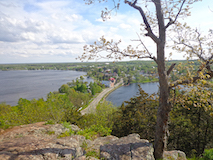 Foley Mountain Conservation Area, the highest conservation area in the Rideau Valley, overlooks Upper Rideau Lake and Westport. The scenic view is second-to-none in Ontario. It features nature trails, beaver pond, wildlife and plants galore. Picnic tables, parking and restrooms are available. Admission is $5.00 per vehicle; donation box at site.
For more information visit their website
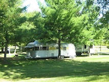 Situated along the shores of the Tay River in Perth the Last Duel Park & Campground offers 46 serviced campsites, public boat docks and launch, public walking trails (The Wendy Laut Ribbon of Life) and picnic area with shelter. A rustic log cabin was added in 2016 and is now available for rent.
For more information visit their website
 Located southwest of Innisville off Drummond Concession 10B, this National Wildlife Area is a haven for migrating waterfowl in the fall. Representing one of the largest natural areas left on Mississippi Lake, the Sanctuary centres around the wetlands of McEwan Bay where stands of wild rice, cattail and other plants provide habitat for spawning fish in the spring, some of the best habitat for bullfrogs in the summer and many different species of birds, mammals and invertebrates. Before September (when boating is prohibited so as not to disturb the migratory birds), a public boat launch is available as well as opportunities to hike.
For more information visit Canada.ca website
 Located at the confluence of the Tay and Rideau River systems was the site of the original Tay Canal, a system of five locks located between the Tay’s mouth and Jebb’s Creek which provided the first reliable water access between the military settlement of Perth and the Rideau Canal network.
Built in the 1830’s, these locks were built of rubble masonry and wooden planking and while they were smaller than those on the Rideau they were indispensable helping move people to and from Perth, as road transportation was almost impossible at the time.
For more information visit their website
 Located just south of the Town of Perth in the Tay Marsh, this 635-acre site is a naturalist’s haven with habitat for deer, wild turkeys, turtles, ducks, geese, bluebirds and many others. The site is owned and maintained as a wildlife management area by the Rideau Valley Conservation Authority and contains a variety of habitats including mature woodlands, plantations, natural meadows and the ecologically significant Tay Marsh wetland. Two nature trails (including interpretive signage) and a viewing tower provide a great opportunity for hiking and wildlife observation.
For more information visit their website
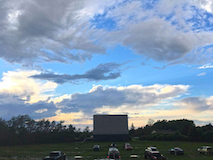 Bring the family out for an evening of good old fashion fun! Established in 1953, the Port Elmsley Drive-In is open May to October.
333 Port Elmsley Road, Port Elmsley, Ontario
Movieline: 613-267-7772
For more information visit their website
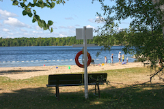 Located on Lower Rideau Lake near the resort community of Rideau Ferry this conservation area consists of ten acres of woodland, meadows and beach. Owned and maintained by the Rideau Valley Conservation Authority, this site provides public day use access to the historic Rideau Canal system, and contains a public boat launch, trail and beach.
For more information visit their website
 The Rideau Ferry Yacht Club welcomes boating enthusiasts of all ages to attend this award-winning regatta. There will be dozens of vintage race boats gathered on the Big Rideau Lake from both Canada and the United States. This biennial event runs in August and is sure to delight boating enthusiasts
For more information visit their website
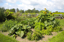 Finding local food just got easier. Lanark Local Flavour’s website is a comprehensive, one-stop shopping guide complete with farmer profiles, locations of farmers’ markets and, a calendar of food-related events. Eating locally is one way anyone can do their part to help lessen the impact of climate change, while at the same time supporting our local food economy.
Purchasing food grown locally not only helps to reduce greenhouse gases – associated with transportation, refrigeration and food processing – it also boosts farm incomes, supports the community and helps to ensure access for everyone to fresh, wholesome, sustainably-produced food.
For more information visit their website
Public Water Access

Access for both motorized and non-motorized boats

Access for non-motorized boats ONLY
For other area tourism destinations, please visit Lanark County’s Tourism site
The Mississippi Valley Conservation Authority and the Rideau Valley Conservation Authority are two agencies which play a role in managing and maintaining the Township of Drummond/North Elmsley’s water and natural resource systems.
Mississippi Valley Conservation Authority (MVCA) is a local watershed management agency that delivers services and programs to help protect and manage water and other natural resources in the Mississippi River Watershed, encompassing 4353 square kilometres.
Using an integrated watershed management approach, the conservation authority works with stakeholders in the watershed to balance the needs of the community with the needs of the natural environment.
MVCA is governed by members appointed from each of the 11 member municipalities, including the Township of Drummond/North Elmsley.
Address: MVCA Administrative Office 10970 Hwy. 7 Carleton Place, ON K7C 3P1
Phone: 613-253-0006
Email: This email address is being protected from spambots. You need JavaScript enabled to view it.
Website: mvc.on.ca
The Rideau Valley Conservation Authority (RVCA) conserves natural resources in the Rideau River Valley, an area of 4234 square kilometres. The RVCA vision is for a thriving watershed with clean abundant water, natural shorelines, rich forests and wetlands, diverse habitat and sustainable land use that is valued and protected by all.
The RVCA works with the Township of Drummond/North Elmsley to review development proposals within or adjacent to natural areas. They also work with the Township to regulate construction in environmentally sensitive areas such as wetlands, shorelines and waterways. In addition, the RVCA reviews proposals to ensure fish habitats are protected and not harmfully altered.
There are 18 member municipalities whose representatives oversee the RVCA work.
Address: Rideau Valley Conservation Centre PO Box 599, 3889 Rideau Valley Drive, Manotick, Ontario K4M 1A5
Phone: 613-692-3571 1-800-267-3504 (toll-free)
Email: This email address is being protected from spambots. You need JavaScript enabled to view it.
Website: rvca.ca
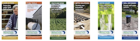
The two Conservations Authorities work together in their geographic areas to implement Ontario’s Clean Water Act, 2006. Source water is the raw water that we take from lakes, rivers or underground aquifers to supply people with drinking water. “Source Water Protection” or “Source Protection” means protecting these sources of drinking water from contamination and overuse. The focus is on prevention and this work is meant to complement the work of water treatment plant operators who ensure municipal drinking water is properly treated, tested and safely delivered to your tap.
Four great reasons to protect drinking water at the source:
1. Water treatment is not always enough.
Water treatment systems do not remove all contaminants from water, particularly some chemicals. The safest approach is to prevent contamination in the first place.
2. Prevention saves money.
It is much cheaper to keep water clean than to try to remove contaminants. A 2010 spill from a home heating oil tank in eastern Ontario cost $1 million to clean up. The spill might have been avoided by ensuring the tank was in good repair.
3. Contamination can ruin a water source forever.
Sometimes contamination cannot be cleaned up and a water supply must be shut down. The community of Manotick, Ontario lost access to its groundwater in the 1990s when it was contaminated by chemicals from a dry cleaning business. Since then, water has been piped into Manotick from urban Ottawa.
4. Source protection has other benefits.
Clean and plentiful sources of drinking water protect property values and support tourism and recreation, business development and fish and wildlife habitat. All of which create healthy local economies and viable, vibrant communities
Intake Protection Zones
The Township has two Intake Protection Zones, one zone borders the Town of Perth along Hwy 511 and Drummond Concession 4A to protect the Town’s drinking water and the other zone is located along Poonamalie Road and protects the Town of Smiths Falls drinking water.
Perth Source Water Protection Area Map
Smiths Falls Source Water Protection Area Map
 Download a series of educational brochures
about Source Water Protection

The Township of Drummond/North Elmsley has two fully serviced facilities that are available for rent for your next special event.
Address: 1920 Drummond Concession 7
Seating Capacity: 48
Download Drummond Hall Rental Agreement
View Drummond Hall Calendar for availability.
For bookings and inquiries for the Drummond Hall, please contact the Township office at 613-267-6500 or email This email address is being protected from spambots. You need JavaScript enabled to view it.
Address: 1362 Ferguson's Falls Road, Ferguson's Falls
Seating Capacity: 150
For bookings and inquiries for Ferguson's Falls Hall, please contact the Township office at 613-267-6500 or email This email address is being protected from spambots. You need JavaScript enabled to view it.
Download the Ferguson's Falls Hall Rental Agreement
View Ferguson's Falls Hall Calendar for availability.
View Ferguson's Falls Hall Inventory List

The Township has its own library, the Perth & District Union Library in partnership with the Town of Perth and Township of Tay Valley. This is our community’s central resource for information and recreational reading. Residents of Drummond/North Elmsley may use the Perth & District Union Public Library free of charge.
Pop Up Library
Working with the Perth Library the Municipal office at 310 Port Elmsley Road is also home to a new Pop Up Library. We are making reading materials more available to residents. If you are in the area have a peek. You can leave a book or take a book.
Archives and Genealogy
Reading provides knowledge and can bring opportunity to learn about our history. Drummond/North Elmsley is well known for archives of information provided by Archives Lanark and the Lanark County Genealogy Society.
Both these organizations work from our former Drummond municipal office located at 1920 Drummond Concession 7. Due to Covid-19 appointments are required before visting the Lanark Archives. Feel free to contact them at,
Email: This email address is being protected from spambots. You need JavaScript enabled to view it.
Website: www.archiveslanark.ca

Mississippi Lakes Association
The Mississippi Lakes Association is a not-for-profit incorporated organization that provides services to their clients, primarily residents with properties surrounding the lake, but also to people coming to Lake Mississippi for recreation -- fishermen, boaters, naturalists, campers, etc.
For more information please visit their website .
The Mississippi Lake Plan Process
The Centre for Sustainable Watersheds (CSW) has partnered with the Mississippi Lakes Association (MLA), French Planning and Mississippi Valley Conservation (MVC) on the development of a Mississippi Lake Plan. The goal of Lake Plan is to identify, protect and restore the natural, physical and social integrity of Mississippi Lake’s ecosystem.
If you have any questions about the process, or how you can help, please contact the Mississippi Lake Association or the Centre for Sustainable Watersheds .
Address: P.O. Box 27 Carleton Place, Ontario K7C 3P3
Email: This email address is being protected from spambots. You need JavaScript enabled to view it.
Website: mississippilakesassociation.org
Otty Lake Association
The Otty Lake Association (OLA) is a not-for-profit voluntary organization. Their members are residents and cottagers of Otty, Little Otty, McLaren and Mud Lakes and Jebbs Creek. The association is committed to the long term health and enjoyment of their lakes and the watershed.
Otty Lake Management Plan
In planning for the long-term health of their lake, the Otty Lake Association & volunteers developed the Otty Lake Management Plan .
Address: Box 20122 Perth, ON K7H 3M6
Email: This email address is being protected from spambots. You need JavaScript enabled to view it.
Website: www.ottylakeassociation.ca
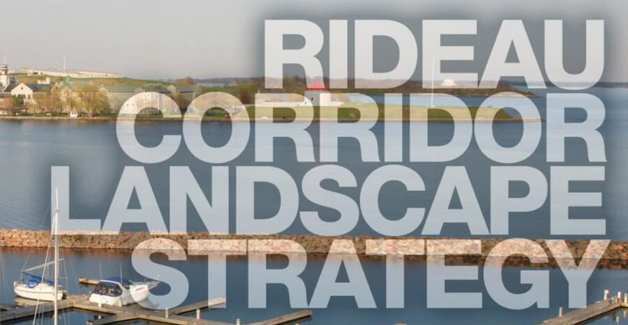
Rideau Corridor Landscape Strategy
Rideau Corridor Landscape Strategy Steering Committee – Parks Canada is the Secretariat for the Strategy and as part of their responsibilities, they have been keeping their website up to date with information regarding Strategy progress. Most recently, they have added a video about the Strategy, which will hopefully raise people's awareness and excitement for this initiative even further.
View the Report - English / French .
Rideau Canal, Parks Canada
Phone: 613-283-5170
Email: This email address is being protected from spambots. You need JavaScript enabled to view it.

Property taxes are the major source of revenue. The base for property taxation is the assessment roll. It defines classes and types of properties which are subject to taxation. The assessment roll comes from the Municipal Property Assessment Corporation [MPAC]. The information included in this roll is then used to determine tax rates and to levy taxes. Tax rates are determined and taxes levied after Council adopts the annual budget of estimated revenues and expenditures.
Tax Contact Details:
For Property Tax inquires This email address is being protected from spambots. You need JavaScript enabled to view it.
For Tax Certificates This email address is being protected from spambots. You need JavaScript enabled to view it.
Phone 613-267-6500 Ext. 242
Property taxes are levied by the Township which provides the main source of revenue to deliver services supplied by the municipality. In addition to collecting its own taxes, the Township is also responsible for levying and collecting education taxes on behalf of the Province of Ontario, which are distributed to school boards located in the Township, as well as on behalf of the County of Lanark.
How Property Taxes are Calculated
To help provide clarity for property owners on how property taxes are calculated, including the link between property assessment, municipal service costs and required tax dollars, watch MPAC’s helpful and informative video.

When you receive your Property Assessment Notice, review it. No further action is required on your part unless you have questions or you disagree with your assessed value and/or classification.
Do you have questions about your Property Assessment Notice? Visit aboutmyproperty.ca or contact the Municipal Property Assessment Corporation (MPAC) Customer Contact Centre at 1-866-296-MPAC (6722), or 1-877-889-MPAC (6722).
If you would like to learn more about how MPAC assessed your property and compare it to others in your neighbourhood, visit aboutmyproperty.ca. You can also review market trends for your municipality and file a Request for Reconsideration. Your unique Roll Number and Access Key are included on your Property Assessment Notice.
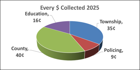
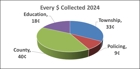
| Property Class | RTC | 2025 Final Tax Rate includes: Municipal, County, Education | 2024 Final Tax Rate includes: Municipal, County, Education |
|---|---|---|---|
| Residential | RTEP/RTES/RTFP/RTFS | 0.01016244 + Local Charge $210.00 | 0.00976819 + Local Charge $210.00 |
| Commercial | CTN | 0.02470897 | 0.02398239 |
| Commercial Vacant | CUN | 0.02470897 | 0.02398239 |
| Industrial | ITN | 0.03065418 | 0.02965609 |
| Pipeline | PTN | 0.02612743 | 0.02533608 |
| Farmland | FTEP/FTES/FTFP/FTFS | 0.00254061 | 0.00244205 |

For other important health links, please visit:
The Perth and Smiths Falls District Hospital
Lanark County Social Services
Rideau Community Health Services
Lanark, Leeds, and Greenville Addictions and Mental Health
Links from this site to other sites are presented as a convenience to the Township of Drummond/North Elmsley website users. The Township does not endorse nor accept any responsibility for the content found at these sites.

When it comes to education the Township of Drummond/North Elmsley offers many options for students.
We are home to two elementary schools; Drummond Centre Public School and North Elmsley Public School, both providing education for learners from JK to Grade 6 and offer a large green space for recreational opportunities for their students and community. Due to our central location, Drummond North/Elmsley offers easy access to secondary and post-secondary institutions.
Roadway Classification System
- Class 4 – Max Speed Limit 80 km/hr.2,000 to 3,999 vehicles per day
- Class 5 – Max Speed Limit 80 km/hr.50 to 1,999 vehicles per day
- Class 6 – Speed Limit less than 80 km/hr.less than 50 vehicles per day
Parking By-law
Any vehicle parked in contravention of this by-law may be towed away at the owner’s risk and expense and shall be liable upon summary conviction to a fine.
Mailboxes
The Township of Drummond/North Elmsley is not responsible for damage to mailboxes, newspaper boxes or parked vehicles that may interfere with the snow plowing of roads.
Restricted Weight Loads Notice (Half-loads)
Restricted loads are usually in effect from March 1st to mid-May. Please check the local newspapers, the Township web site or call 613-267-6500 to confirm schedule.
Reporting Street Light Outages
Please call the Township Office at 613-267-6500 to report a streetlight that is out/cycling/flickering. We will need the pole number, or the closest civic address number, and the road name.
Entrance & Civic Address Sign Permits/Fees
Costs associated with these permits are as follows:
Entrance Permit $100
- A deposit of $900 is required prior to the approval of the permit.
- This deposit will be returned provided that the installation is complete and meets the requirements of the entrance approval.
Civic Address - Sign NewNumber assignment, sign & post $120.00
Civic Address - Replacement
Replacement, Sign only, $50.00
Replacement, Post only, $40.00
Municipal Consent
Any work being completed within the Township road allowance requires approval by the Township.
Please complete the Municipal Consent application and submit it along with detailed drawings to
This email address is being protected from spambots. You need JavaScript enabled to view it..
More...
Welcome! Thank you for joining our community
The Township's website gives you all the information you need to make your home in Drummond/North Elmsley and enjoy your life here. View the following links for the most popular information requested by newcomers.
Services:
Explore & Play:

Drummond/North Elmsley runs a curbside collection program through an independent contractor. Recycle pickup dates are on the same day as regular garbage pickup, and there are no interruptions during the year except when Christmas and New Year's days falls on your regular pickup day. Make sure you put your garbage and recycling at the curbside by 7:00 a.m. on the scheduled day of collection.
We also have a landfill site at 745 Code Road. Please see the Waste Matters Brochure for more information.
Weekly Garbage and Recycling Schedule
Download the Curbside Collection Schedule here
| 15 Dec 2025 Monday Garbage Pickup - Blue Bins Garbage - Blue Bins |
| 16 Dec 2025 Tuesday Garbage Pickup - Blue Bins Garbage - Blue Bins |
| 17 Dec 2025 Wednesday Garbage Pickup - Blue Bins Garbage - Blue Bins |
Find Your Curbside Collection Day
View the 4 Day Curbside Collection Map
| Street | Pickup Day |
|---|---|
| ACACIA RD | Monday |
| ALBERT LN | Monday |
| ARNOLD DR | Monday |
| BARR PLACE | Monday |
| BAYSIDE RD | Monday |
| BAYVIEW RD | Monday |
| BECK SHORE | Monday |
| BERNICE CRESCENT | Monday |
| BEST LANE | Monday |
| BEVERIDGE LOCKS RD | Monday |
| BIRCH GROVE LANE | Monday |
| BIRCH GROVE RD | Monday |
| BISHOPS WAY | Monday |
| BLACK BASS BAY RD | Monday |
| BOURGAIZE RD | Monday |
| BURGESS DR | Monday |
| CARSON CIRCLE | Monday |
| CATS COVE | Monday |
| CEDAR CREST | Monday |
| CHAMNEY SHORE | Monday |
| CHARLIE DR | Monday |
| CHURCH AVE | Monday |
| CLIFFORD CRESCENT | Monday |
| COLEMAN DR | Monday |
| COMMAND RD | Monday |
| COMODORE ISLAND RD. | Monday |
| COOKE'S SHORE | Monday |
| COUTTS BAY RD | Monday |
| CRAIG'S LANE | Monday |
| CRAIG'S SHORE | Monday |
| DAROU DR | Monday |
| DOUGLAS DR | Monday |
| DRUMMOND CON 7 - EAST OF HWY 7 | Monday |
| DRUMMOND CON 7B | Monday |
| DRUMMOND CON 9A - EAST OF HWY 7 | Monday |
| DRUMMOND CON 9B | Monday |
| DUNLOP CRESCENT | Monday |
| EBBS BAY DR | Monday |
| EBBS BAY RD - after it turns off Conc 11. Starting at civic 1048 | Monday |
| ECHO BAY DR | Monday |
| ELIZABETH DR | Monday |
| ELM CREST | Monday |
| ELM GROVE RD | Monday |
| ELMSLEY CRESCENT | Monday |
| ELMSLEY DR | Monday |
| FIRST AVE | Monday |
| FLAT ROCK LANE | Monday |
| FLINTOFF BAY | Monday |
| FORREST DR | Monday |
| FOURWAY DR | Monday |
| FREEDOM HILL RD. | Monday |
| GRASSHOPPER POINT | Monday |
| GRASSMERE LN | Monday |
| HARDWOOD LANE | Monday |
| HARDWOOD RD | Monday |
| HEALEY DR | Monday |
| HILLVIEW RD | Monday |
| HILLVIEW RD A | Monday |
| HUGHES RD | Monday |
| HUNTER'S BAY RD | Monday |
| JODI LANE | Monday |
| KAREN LANE | Monday |
| KEN DON LANE | Monday |
| KERR RD | Monday |
| KIMBERLY LANE | Monday |
| LAKE LN | Monday |
| LAKEVIEW RD | Monday |
| LAKEWOOD LANE | Monday |
| LEWIS LANE | Monday |
| LOON DR | Monday |
| LUMBERJACK TR | Monday |
| MACHIN DR | Monday |
| MALLOCH'S LANDING | Monday |
| MALLOCH'S LANDING 1 | Monday |
| MALLOCH'S LANDING 2 | Monday |
| MANOR WAY | Monday |
| MAPLE CREST LANE | Monday |
| MAPLEBUSH TR | Monday |
| MARY MILLER RD | Monday |
| MARY ST | Monday |
| MCCULLOUGH'S LANDING | Monday |
| MCKAY FARM RD | Monday |
| MCLAREN DR | Monday |
| MCLEAN'S BAY RD | Monday |
| MCNAUGHTON DR | Monday |
| MCVEETY RD | Monday |
| MCVEIGH MORRIS DR | Monday |
| MILE POINT RD | Monday |
| MILLAR BROOKE WAY | Monday |
| MOSS SHORE | Monday |
| NORWAY POINT RD. | Monday |
| OAK DR | Monday |
| OLD WAGON RD | Monday |
| OTTY LAKE SIDE RD | Monday |
| OTTY WAY | Monday |
| PICKEREL POINT RD | Monday |
| PINE DR | Monday |
| POINTVIEW DR | Monday |
| POOLE DR | Monday |
| PORT ELMSLEY RD | Monday |
| PRETTIES ISLAND RD | Monday |
| RED ROCK BAY | Monday |
| RIDEAU COURT | Monday |
| RIDEAU FERRY RD | Monday |
| RIDEAU LAKE RD | Monday |
| RIDEAU ST | Monday |
| ROBERT RUN | Monday |
| ROBINS LANE | Monday |
| ROSE MAC DR | Monday |
| ROTHWELL PARK RD | Monday |
| ROTHWELL RD | Monday |
| RYDER RD | Monday |
| SCOTCH LINE | Monday |
| SECOND AVE | Monday |
| SETTLERS LANE | Monday |
| SHEIL DR | Monday |
| SHERWOOD ST | Monday |
| SHORE AVE | Monday |
| SONGBIRD LANE | Monday |
| SOUTH ST | Monday |
| STONEDGE LANE | Monday |
| SUGARBUSH DR | Monday |
| SUMAC LANE | Monday |
| SUNRISE LANE | Monday |
| SUNSET DR | Monday |
| SUNSETVIEW RD | Monday |
| SUTCLIFF LN | Monday |
| TAYVIEW DR | Monday |
| THOMAS TRAIL | Monday |
| THOMPSON DR | Monday |
| THREE BAY RD | Monday |
| TINA DR | Monday |
| TRILLIUM DR | Monday |
| TRILLIUM POINT RD | Monday |
| WEST POINT DR | Monday |
| WHIPPOORWILL DR | Monday |
| WILD GRAPE LANE | Monday |
| WILD LIFE RD | Monday |
| WILLOW WAY | Monday |
| YACHT CLUB RD | Monday |
| ARMSTRONG SIDE RD | Tuesday |
| BAPTIST CHURCH SIDE RD | Tuesday |
| BARRIE'S SIDE RD | Tuesday |
| BENNETT ST | Tuesday |
| CAMERON DR | Tuesday |
| COLLING'S ST | Tuesday |
| CRAIN DRIVE | Tuesday |
| DRUMMOND CON 10A | Tuesday |
| DRUMMOND CON 10B- West of Hwy 7 | Tuesday |
| DRUMMOND CON 12A | Tuesday |
| DRUMMOND CON 12B | Tuesday |
| DRUMMOND CON 4A | Tuesday |
| DRUMMOND CON 4B | Tuesday |
| DRUMMOND CON 5A | Tuesday |
| DRUMMOND CON 5B – WEST of HWY 7 | Tuesday |
| DRUMMOND CON 6A | Tuesday |
| DRUMMOND CON 7 – WEST of HWY 7 | Tuesday |
| DRUMMOND CON 8A | Tuesday |
| DRUMMOND CON 8B | Tuesday |
| DRUMMOND CON 9A – WEST OF HWY 7 | Tuesday |
| DRUMMOND SCHOOL RD | Tuesday |
| DUFFERIN RD | Tuesday |
| DUNLOP SIDE RD | Tuesday |
| EBBS SIDE RD | Tuesday |
| EWART AVE | Tuesday |
| FERGUSON’S FALLS RD | Tuesday |
| GARDINER RD | Tuesday |
| GEORGINA ST | Tuesday |
| GOLD CREEK RD | Tuesday |
| HALEY LAKE RD | Tuesday |
| HARROP RD | Tuesday |
| HIGHWAY 511 | Tuesday |
| HIGHWAY 7 - WEST side from 10B down to Perth and back up the EAST side to 5B. | Tuesday |
| HOOP'S SIDE RD | Tuesday |
| HOUSTON RD | Tuesday |
| HUDSON RD | Tuesday |
| JEROME ST | Tuesday |
| JOHN'S RD | Tuesday |
| LEACH'S RD West of HWY 7 | Tuesday |
| MAPLE LANE RD | Tuesday |
| MCDONALDS CORNERS RD. | Tuesday |
| MCILQUHAM BLAIR RD | Tuesday |
| MCLELLAN RD | Tuesday |
| MCPHERSON WAY | Tuesday |
| MILL ST | Tuesday |
| MILLER DR | Tuesday |
| MONTGOMERY RD | Tuesday |
| MORRIS RD NORTH | Tuesday |
| MORRIS RD SOUTH | Tuesday |
| OAK LANE | Tuesday |
| PARKS BAY LANE | Monday |
| PAUL'S RD | Tuesday |
| PHELANS RD | Tuesday |
| PRESTONVALE RD | Tuesday |
| PROSPECT ST | Tuesday |
| RICHMOND'S RD | Tuesday |
| RIVERBEND DR | Tuesday |
| SHELDON PLACE | Tuesday |
| SPRUCE RD | Tuesday |
| STAMFORD DRIVE | Tuesday |
| THOMSON SIDE RD | Tuesday |
| TOLL RD | Tuesday |
| TOWNSHIP BOUNDARY RD | Tuesday |
| TULLIS LANE | Tuesday |
| WATER ST | Tuesday |
| WAYSIDE RD | Tuesday |
| WESTINE DR | Tuesday |
| WIDENMAIER RD | Tuesday |
| BAY ST | Wednesday |
| BEAR ISLAND RD | Wednesday |
| BRITTANY WAY | Wednesday |
| CASSIDY CRESCENT | Wednesday |
| CHURCHILL AVE | Wednesday |
| CODE RD | Wednesday |
| CRAMPTON RD | Wednesday |
| DANNY DR | Wednesday |
| DEAN RIDGE | Wednesday |
| DRUMMOND CON 10B - EAST OF HWY 7 | Wednesday |
| DRUMMOND CON 11 | Wednesday |
| DRUMMOND CON 12C | Wednesday |
| DRUMMOND CON 12D | Wednesday |
| DRUMMOND CON 2 | Wednesday |
| DRUMMOND CON 2A | Wednesday |
| DRUMMOND CON 4C | Wednesday |
| DRUMMOND CON 4D | Wednesday |
| DRUMMOND CON 5B - EAST OF HWY 7 | Wednesday |
| DRUMMOND CON 6B | Wednesday |
| EBBS BAY RD - from HWY 7 to Drummond Conc 11 to Beckwith boundary. | Wednesday |
| HAND'S RD | Wednesday |
| HIGHWAY 7 - East side from 5B to the top of the township and down the west side of HWY 7 to 10B. | Wednesday |
| INNISVILLE ISABELLA ST | Wednesday |
| INNISVILLE N | Wednesday |
| INNISVILLE S | Wednesday |
| INNISVILLE WATER ST | Wednesday |
| INNISVILLE WELLINGTON ST. | Wednesday |
| ISLANDVIEW DR | Wednesday |
| JACKSON DR | Wednesday |
| JERICHO RD | Wednesday |
| KELLY'S PARK RD 1 | Wednesday |
| KELLY'S PARK RD 2 | Wednesday |
| LEACH'S RD | Wednesday |
| MACPHAIL'S RD | Wednesday |
| MOORE DR | Wednesday |
| MOULTON RD | Wednesday |
| MUNLAREN RD | Wednesday |
| RAPIDS RD | Wednesday |
| SHAIL RD | Wednesday |
| TENNYSON RD | Wednesday |
| THE OLD RD | Wednesday |
| WESTSHORE DR | Wednesday |
| WHITE RD | Wednesday |
| ARMSTRONG RD | Thursday |
| BEST RD | Thursday |
| BURNS RD | Thursday |
| BUTTERMILK HILL RD | Thursday |
| CANAL BANK RD | Thursday |
| CAPTAIN SHERWOOD DR | Thursday |
| CARROLL RD | Thursday |
| CASSELLVILLE LANE | Thursday |
| CENTRE DR | Thursday |
| CHURCHILL RD | Thursday |
| CROMWELL CRESCENT | Thursday |
| DANIEL CRAIN DR | Thursday |
| DOPSON RD | Thursday |
| DRUMMOND CON 1 | Thursday |
| DUNCAN ST | Thursday |
| EBERT RD | Thursday |
| EVANS RD | Thursday |
| FOSTER SIDE RD | Thursday |
| FRIZZELL RD | Thursday |
| GLENVIEW RD | Thursday |
| HIGHWAY 43 | Thursday |
| IRWIN ST | Thursday |
| JAMES CRAIN DR | Thursday |
| LESLIE CRAIN DR | Thursday |
| MAZIE ST | Thursday |
| MCLACHLIN RD | Thursday |
| MEADOW LANE | Thursday |
| MOORES PL | Thursday |
| MOORES RD | Thursday |
| NORTH RD | Thursday |
| OLD PLANK RD | Thursday |
| PINE AVE | Thursday |
| POONAMALIE SIDE RD | Thursday |
| PORTER RD | Thursday |
| RATHWELL RD | Thursday |
| RICHARDSON SIDE RD | Thursday |
| RIVERS EDGE | Thursday |
| SALTER LANE | Thursday |
| SAUMURE CIRCLE | Thursday |
| SCHOLTON RD | Thursday |
| SPENCE RD | Thursday |
| SPINELLI LN (Spinelli Mobile Home Park) | Thursday |
| STATION RD | Thursday |
| STONE RD | Thursday |
| STONE RD EAST | Thursday |
| WESTERN AVE | Thursday |
| WILD APPLE LANE | Monday |
| ZACH'S LANE | Thursday |
| BLUE HERON RD | Boundary Road agreement: PICKED-UP BY MISSISSIPPI MILLS - THURSDAY |
| DAY RD | Boundary Road agreement: PICKED-UP BY BECKWITH - MONDAY |
| SCOTCH CORNERS RD | Boundary Road agreement: PICKED-UP BY BECKWITH - MONDAY |

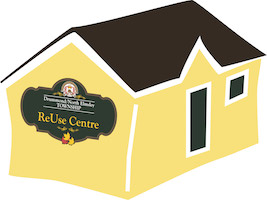 The ReUse Centre at the Code Road Landfill accepts furniture, kitchen items, books, magazines, sports equipment, toys, bikes and volunteers!
The ReUse Centre is currently CLOSED for the season!
Note: No Clothing. No Mattresses. No Freon Appliances. Only Drummond/North Elmsley residents may donate to the ReUse Centre, but all are welcome to take items home.
The ReUse Centre is closed for the 2025 season on November 1, 2025.
Reopening on May 1, 2026 for the summer and closed for the winter on November 2, 2026.
Backyard Composting
Backyard composters can be homemade or purchased at various stores!
These resources are available to get you started and keep you going. Composting is an excellent eco-friendly family project
Compost Depots for Yard Waste 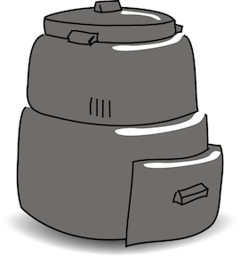
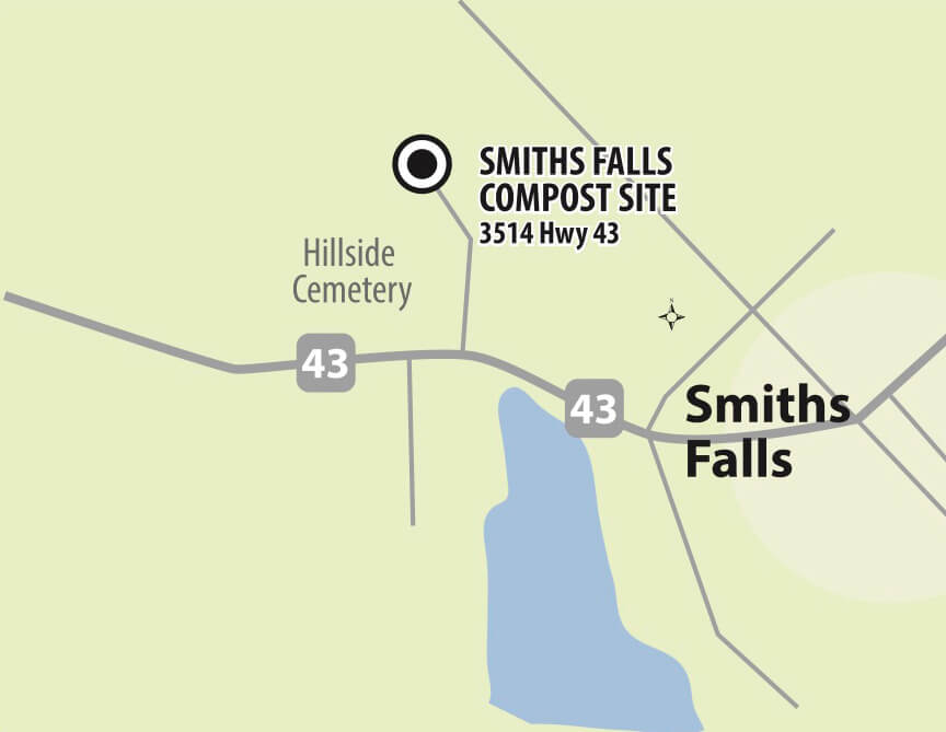
Residents who wish to dispose of leaves, grass clippings and brush may bring these materials year-round to the Code Road Landfill, and seasonally, to the Smiths Falls Compost Site located on Highway 43 beside the Hillcrest Cemetery.
Food and kitchen wastes are not accepted at either facility for composting. Please note that you also have the option to take some nutrient rich compost from the Smiths Falls Compost Site while supplies last.
SMITHS FALLS COMPOST SITE
3514 Hwy 43, Smiths Falls
East of Hillside Cemetery
May 9 – Nov. 1, 2026
Saturdays 8 am – 4 pm
Get Directions
May 6 – June 24, 2026
Wednesdays 9 am – 3 pm
Get Directions
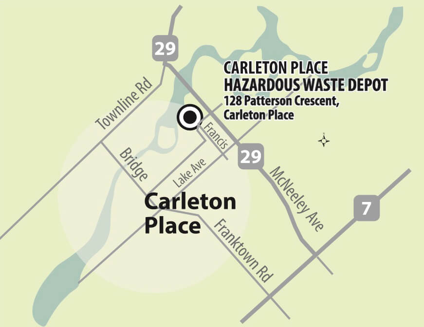
Hazardous Waste Depot
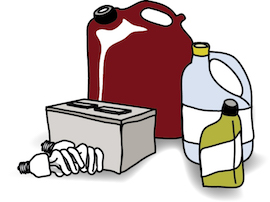 Drummond/North Elmsley residents can bring their hazardous waste to the CARLETON PLACE HAZARDOUS WASTE DEPOT.
- No tipping fees
- Proof of residency is required
Waste Items Accepted
- Flourescent Light Bulbs (cfl’S) & Flourescent Tubes (48” AND OTHER)
- Mercury (Mercury Filled Thermometers, Thermostats)
- Motor Oil, Antifreeze, Oil Filters
- Flammable Liquids (Gasoline, Solvents, Strippers, Turpentine)
- Latex Paint, oil Paint & Stain
- Organic Flammables (Adhesives, Driveway Sealant, Caulk, Resin)
- Propane Cylinders
- Lead Acid Vehicle Batteries or Dry Cell Batteries
- Aerosol Cans
- Acid or Base Corrosives (Cleaners, Drain Openers, Rust Remover)
- Pesticides
- Oxidizers (Pool Chemicals, Fertilizer)
- Fire Extinguishers
For a more information on what waste items are accepted download the Household Hazardous Waste Depot Brochure
CARLETON PLACE HAZARDOUS WASTE DEPOT
128 Patterson Crescent, Carleton Place
2025 DATES
May 16 - September 5, 2026
Saturdays 8 am – 12 noon
Get Directions


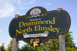
The Township of Drummond/North Elmsley was created in 1998 by the merging of the Townships of Drummond and North Elmsley. It is located in central Lanark County and has a population of 8,183 according to the 2021 Census.
It is a mostly rural municipality and is bounded by the Historic Rideau River Waterway to the south and the Mississippi River to the northwest. It includes the Hamlets of Port Elmsley, Balderson, Innisville, Wayside, Drummond Centre, Ferguson’s Falls and Rideau Ferry. The southern portion of the municipality features many lakes, rivers and mixed forests while the more western and northern areas feature rolling hills and fertile farmland. The Township is considered the southern gateway to Lanark County’s “Maple Syrup Trail”. For those familiar with the equestrian world, the municipality is home to world champion Ian Millar of Millar Brooke Farm.
The Township enjoys the conveniences of both the Town of Perth and the Town of Smiths Falls. Both towns are rich with heritage and tourist attractions offering excellent shopping and convenient access to businesses.
The Township contributes to a variety of recreational facilities which includes community centres with arenas; an outdoor and indoor swimming pool; an outdoor fully equipped community park and a full service library. A host of other private and community based facilities including: a variety of golf courses, curling rinks, the Rideau Canal, Tay River, Otty Lake, Perh Wildlife Reserve, RVCA Yacht Club Road Beach, Mississippi River and lake, and walking trails.
There are two public schools, Drummond Central School and North Elmsley Public School. In close proximity are the Perth campus of Algonquin College and the Perth and Smiths Falls District Hospitals, which are also supplemented by a full range of medical related clinics and practices found throughout the community.
Click here for Map of Drummond/North Elmsley.
Download the Township Brochure