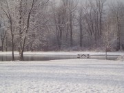
Living (24)
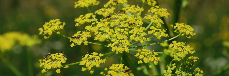
The Public Works Department will be documenting all Wild Parsnip on road allowances throughout the Township. The County of Lanark has further information on their website regarding noxious weeds.
For 2025, the Road Side Spray program will be spraying the locations listed in the following document.
2025 Spray Locations
Road Side spraying is expected to be completed between June 2 - July 4, 2025. It is weather dependent, and the Township will post a public notice prior to commencement.
If you do not want road side spraying adjacent to your property, please fill out a copy of the ‘No Spray Agreement’ and return to the Township office.
For further information please see Wild Parsnip- Best practices Ontario.
Here you will find an alphabetical list of cemeteries in the Township. For further information regarding inactive cemeteries please call the Township at 613-267-6500.
Additional Information
Internet Service Providers:
Please note that the contents and information provided below are meant to provide general information only to interested parties. The Township does not promote any specific Internet Service Provider.
Coverage Maps:
- Bell Internet (Map) Opens in new window
- Cogeco – check availability by address – there is no map Opens in new window
- National Broadband Internet Service Availability Map Opens in new window
- Storm Internet Coverage (Map) Opens in new window
- WTC Communications (Map) Opens in new window
- Xplornet (no map) Opens in new window
The Reeve and members of Council honour the residents of Drummond/North Elmsley, especially on a milestone occasion. If you're interested please complete the Congratulatory Message Request and we will ensure that the celebrant(s) receive a congratulatory message. If would like to obtain more information, please call 613-267-6500 or email This email address is being protected from spambots. You need JavaScript enabled to view it.
| Street | Pickup Day |
|---|---|
| ACACIA RD | Monday |
| ALBERT LN | Monday |
| ARMSTRONG RD | Thursday |
| ARMSTRONG SIDE RD | Tuesday |
| ARNOLD DR | Monday |
| BAPTIST CHURCH SIDE RD | Tuesday |
| BARR PLACE | Monday |
| BARRIE'S SIDE RD | Tuesday |
| BAY ST | Wednesday |
| BAYSIDE RD | Monday |
| BAYVIEW RD | Monday |
| BEAR ISLAND RD | Wednesday |
| BECK'S SHORE | Monday |
| BENNETT ST | Tuesday |
| BERNICE CRESCENT | Monday |
| BEST LANE | Monday |
| BEST RD | Thursday |
| BEVERIDGE LOCKS RD | Monday |
| BIRCH GROVE LANE | Monday |
| BIRCH GROVE RD | Monday |
| BISHOPS WAY | Monday |
| BLACK BASS BAY RD | Monday |
| BOURGAIZE RD | Monday |
| BRITTANY WAY | Wednesday |
| BURGESS DR | Monday |
| BURNS RD | Thursday |
| BUTTERMILK HILL RD | Thursday |
| CAMERON DR | Tuesday |
| CANAL BANK RD | Thursday |
| CAPTAIN SHERWOOD DR | Thursday |
| CARROLL RD | Thursday |
| CARSON CIRCLE | Monday |
| CASSELLVILLE LANE | Thursday |
| CATS COVE | Monday |
| CEDAR CREST | Monday |
| CENTRE DR | Thursday |
| CHAMNEY SHORE | Monday |
| CHARLIE DR | Monday |
| CHURCH AVE | Monday |
| CHURCHILL AVE | Wednesday |
| CHURCHILL RD | Thursday |
| CLIFFORD CRESCENT | Monday |
| CODE RD | Wednesday |
| COLEMAN DR | Monday |
| COLLING'S ST | Tuesday |
| COMMAND RD | Monday |
| COMODORE ISLAND RD. | Monday |
| COOKE'S SHORE | Monday |
| COUTTS BAY RD | Monday |
| CRAIG'S LANE | Monday |
| CRAIG'S SHORE | Monday |
| CRAIN DRIVE | Tuesday |
| CRAMPTON RD | Wednesday |
| CROMWELL CRESCENT | Thursday |
| DANIEL CRAIN DR | Thursday |
| DAROU DR | Monday |
| DEAN RIDGE | Wednesday |
| DOPSON RD | Thursday |
| DOUGLAS DR | Monday |
| DRUMMOND CON 1 | Thursday |
| DRUMMOND CON 10A | Tuesday |
| DRUMMOND CON 10B - EAST OF HWY 7 | Wednesday |
| DRUMMOND CON 10B- West of Hwy 7 | Tuesday |
| DRUMMOND CON 11 | Wednesday |
| DRUMMOND CON 12A | Tuesday |
| DRUMMOND CON 12B | Tuesday |
| DRUMMOND CON 12C | Wednesday |
| DRUMMOND CON 12D | Wednesday |
| DRUMMOND CON 2 | Wednesday |
| DRUMMOND CON 2A | Wednesday |
| DRUMMOND CON 4A | Tuesday |
| DRUMMOND CON 4B | Tuesday |
| DRUMMOND CON 4C | Wednesday |
| DRUMMOND CON 4D | Wednesday |
| DRUMMOND CON 5A | Tuesday |
| DRUMMOND CON 5B - EAST OF HWY 7 | Wednesday |
| DRUMMOND CON 5B – WEST of HWY 7 | Tuesday |
| DRUMMOND CON 6A | Tuesday |
| DRUMMOND CON 6B | Wednesday |
| DRUMMOND CON 7 - EAST OF HWY 7 | Monday |
| DRUMMOND CON 7 – WEST of HWY 7 | Tuesday |
| DRUMMOND CON 7B | Monday |
| DRUMMOND CON 8A | Tuesday |
| DRUMMOND CON 8B | Tuesday |
| DRUMMOND CON 9A - EAST OF HWY 7 | Monday |
| DRUMMOND CON 9A – WEST OF HWY 7 | Tuesday |
| DRUMMOND CON 9B | Monday |
| DRUMMOND SCHOOL RD | Tuesday |
| DUFFERIN RD | Tuesday |
| DUNCAN ST | Thursday |
| DUNLOP CRESCENT | Monday |
| DUNLOP SIDE RD | Tuesday |
| EBBS BAY RD - after it turns off Conc 11. Starting at civic 1048 | Monday |
| EBBS SIDE RD | Tuesday |
| EBERT RD | Thursday |
| ECHO BAY DR | Monday |
| ELIZABETH DR | Monday |
| ELM CREST | Monday |
| ELM GROVE RD | Monday |
| ELMSLEY CRESCENT | Monday |
| ELMSLEY DR | Monday |
| EVANS RD | Thursday |
| EWART AVE | Tuesday |
| FERGUSON’S FALLS RD | Tuesday |
| FIRST AVE | Monday |
| FLAT ROCK LANE | Monday |
| FLINTOFF BAY | Monday |
| FORREST DR | Monday |
| FOSTER SIDE RD | Thursday |
| FOURWAY DR | Monday |
| FREEDOM HILL RD. | Monday |
| FRIZZELL RD | Thursday |
| GARDINER RD | Tuesday |
| GEORGINA ST | Tuesday |
| GLENVIEW RD | Thursday |
| GOLD CREEK RD | Tuesday |
| GRASSHOPPER POINT | Monday |
| GRASSMERE LN | Monday |
| HALEY LAKE RD | Tuesday |
| HAND'S RD | Wednesday |
| HARDWOOD LANE | Monday |
| HARDWOOD RD | Monday |
| HARROP RD | Tuesday |
| HEALEY DR | Monday |
| HIGHWAY 43 | Thursday |
| HIGHWAY 511 | Tuesday |
| HIGHWAY 7 - East side from 5B to the top of the township and down the west side of HWY 7 to 10B. | Wednesday |
| HIGHWAY 7 - WEST side from 10B down to Perth and back up the EAST side to 5B. | Tuesday |
| HILLVIEW RD | Monday |
| HILLVIEW RD A | Monday |
| HOOP'S SIDE RD | Tuesday |
| HOUSTON RD | Tuesday |
| HUDSON RD | Tuesday |
| HUGHES RD | Monday |
| HUNTER'S BAY RD | Monday |
| INNISVILLE ISABELLA ST | Wednesday |
| INNISVILLE N | Wednesday |
| INNISVILLE S | Wednesday |
| INNISVILLE WATER ST | Wednesday |
| INNISVILLE WELLINGTON ST. | Wednesday |
| IRWIN ST | Thursday |
| ISLANDVIEW DR | Wednesday |
| JACKSON DR | Wednesday |
| JAMES CRAIN DR | Thursday |
| JERICHO RD | Wednesday |
| JEROME ST | Tuesday |
| JODI LANE | Monday |
| JOHN'S RD | Tuesday |
| KAREN LANE | Monday |
| KELLY'S PARK RD 1 | Wednesday |
| KELLY'S PARK RD 2 | Wednesday |
| KEN DON LANE | Monday |
| KERR RD | Monday |
| KIMBERLY LANE | Monday |
| LAKE LN | Monday |
| LAKEVIEW RD | Monday |
| LAKEWOOD LANE | Monday |
| LEACH'S RD | Wednesday |
| LEACH'S RD West of HWY 7 | Tuesday |
| LESLIE CRAIN DR | Thursday |
| LEWIS LANE | Monday |
| LOON DR | Monday |
| LUMBERJACK TR | Monday |
| MACHIN DR | Monday |
| MACPHAIL'S RD | Wednesday |
| MALLOCH'S LANDING | Monday |
| MALLOCH'S LANDING 1 | Monday |
| MALLOCH'S LANDING 2 | Monday |
| MANOR WAY | Monday |
| MAPLE CREST LANE | Monday |
| MAPLE LANE RD | Tuesday |
| MAPLEBUSH TR | Monday |
| MARY MILLER RD | Monday |
| MARY ST | Monday |
| MAZIE ST | Thursday |
| MCCULLOUGH'S LANDING | Monday |
| MCDONALDS CORNERS RD. | Tuesday |
| MCILQUHAM BLAIR RD | Tuesday |
| MCKAY FARM RD | Monday |
| MCLACHLIN RD | Thursday |
| MCLAREN DR | Monday |
| MCLEAN'S BAY RD | Monday |
| MCLELLAN RD | Tuesday |
| MCNAUGHTON DR | Monday |
| MCPHERSON WAY | Tuesday |
| MCVEETY RD | Monday |
| MCVEIGH MORRIS DR | Monday |
| MEADOW LANE | Thursday |
| MILE POINT RD | Monday |
| MILL ST | Tuesday |
| MILLAR BROOKE WAY | Monday |
| MILLER DR | Tuesday |
| MONTGOMERY RD | Tuesday |
| MOORE DR | Wednesday |
| MOORES PL | Thursday |
| MOORES RD | Thursday |
| MORRIS RD NORTH | Tuesday |
| MORRIS RD SOUTH | Tuesday |
| MOSS SHORE | Monday |
| MOULTON RD | Wednesday |
| MUNLAREN RD | Wednesday |
| NORTH RD | Thursday |
| NORWAY POINT RD. | Monday |
| OAK DR | Monday |
| OAK LANE | Tuesday |
| OLD PLANK RD | Thursday |
| OLD WAGON RD | Monday |
| OTTY LAKE SIDE RD | Monday |
| OTTY WAY | Monday |
| PAUL'S RD | Tuesday |
| PHELANS RD | Tuesday |
| PICKEREL POINT RD | Monday |
| PINE AVE | Thursday |
| PINE DR | Monday |
| POINTVIEW DR | Monday |
| POOLE DR | Monday |
| POONAMALIE SIDE RD | Thursday |
| PORT ELMSLEY RD | Monday |
| PORTER RD | Thursday |
| PRESTONVALE RD | Tuesday |
| PRETTIES ISLAND RD | Monday |
| PROSPECT ST | Tuesday |
| RAPIDS RD | Wednesday |
| RATHWELL RD | Thursday |
| RED ROCK BAY | Monday |
| RICHARDSON SIDE RD | Thursday |
| RICHMOND'S RD | Tuesday |
| RIDEAU COURT | Monday |
| RIDEAU FERRY RD | Monday |
| RIDEAU LAKE RD | Monday |
| RIDEAU ST | Monday |
| RIVERBEND DR | Tuesday |
| RIVERS EDGE | Thursday |
| ROBERT RUN | Monday |
| ROBINS LANE | Monday |
| ROSE MAC DR | Monday |
| ROTHWELL PARK RD | Monday |
| ROTHWELL RD | Monday |
| RYDER RD | Monday |
| SALTER LANE | Thursday |
| SAUMURE CIRCLE | Thursday |
| SCHOLTON RD | Thursday |
| SCOTCH LINE | Monday |
| SECOND AVE | Monday |
| SETTLERS LANE | Monday |
| SHAIL RD | Wednesday |
| SHEIL DR | Monday |
| SHELDON PLACE | Tuesday |
| SHERWOOD ST | Monday |
| SHORE AVE | Monday |
| SONGBIRD LANE | Monday |
| SOUTH ST | Monday |
| SPENCE RD | Thursday |
| SPINELLI LN (Spinelli Mobile Home Park) | Thursday |
| SPRUCE RD | Tuesday |
| STAMFORD DRIVE | Tuesday |
| STATION RD | Thursday |
| STONE RD | Thursday |
| STONE RD EAST | Thursday |
| STONEDGE LANE | Monday |
| SUGARBUSH DR | Monday |
| SUMAC LANE | Monday |
| SUNRISE LANE | Monday |
| SUNSET DR | Monday |
| SUNSETVIEW RD | Monday |
| SUTCLIFF LN | Monday |
| TAYVIEW DR | Monday |
| TENNYSON RD | Wednesday |
| THE OLD RD | Wednesday |
| THOMAS TRAIL | Monday |
| THOMPSON DR | Monday |
| THOMSON SIDE RD | Tuesday |
| THREE BAY RD | Monday |
| TINA DR | Monday |
| TOLL RD | Tuesday |
| TOWNSHIP BOUNDARY RD | Tuesday |
| TRILLIUM DR | Monday |
| TRILLIUM POINT RD | Monday |
| TULLIS LANE | Tuesday |
| WATER ST | Tuesday |
| WAYSIDE RD | Tuesday |
| WEST POINT DR | Monday |
| WESTERN AVE | Thursday |
| WESTINE DR | Tuesday |
| WESTSHORE DR | Wednesday |
| WHIPPOORWILL DR | Monday |
| WHITE RD | Wednesday |
| WIDENMAIER RD | Tuesday |
| WILD GRAPE LANE | Monday |
| WILD LIFE RD | Monday |
| WILLOW WAY | Monday |
| YACHT CLUB RD | Monday |
| ZACH'S LANE | Thursday |
| BLUE HERON RD | Boundary Road agreement: PICKED-UP BY MISSISSIPPI MILLS - THURSDAY |
| DAY RD | Boundary Road agreement: PICKED-UP BY BECKWITH - MONDAY |
| SCOTCH CORNERS RD | Boundary Road agreement: PICKED-UP BY BECKWITH - MONDAY |
Township of Drummond/North Elmsley, Tay Valley Township, and the Town of Perth - Joint Recreation Master Plan
The Township of Drummond/North Elmsley, Tay Valley Township, and the Town of Perth are embarking on the preparation of a joint Recreation Master Plan to guide the municipalities’ direction in planning recreational facilities and services. Sierra Planning and Management has been commissioned to develop the Master Plan. The principal objectives of the project are to determine community priorities and develop a series of recommendations and action steps to accommodate the current and future recreational needs of the three municipalities. The Plan will guide future investment in facilities, programs, services and partnerships.
Get involved!
The Master Plan will be developed through a comprehensive consultation process, including public engagement sessions and public and user group online surveys. Keep checking this webpage to follow progress of the project and see how you can provide your input to the Master Plan.
Proposed project and community engagement timeline
- Public introductory meetings:
- Sat July 20th from 09:30 to 11:30 am at the Lanark County Council Chambers, 99 Christie Lake Road, Perth, ON K7H 3C6
- Tues July 23rd from 5:30 to 7:30 pm at the Lanark County Council Chambers, 99 Christie Lake Road, Perth, ON K7H 3C6
- Online public and user group survey: Commencing late July 2019
- Public Open House: Mid-October 2019
- Submission of the final Joint Recreation Master Plan: Early December 2019
Community Food Calendars are now available for Perth, Smiths Falls, Almonte, Carleton Place and Lanark Highlands, Brockville, and Rural Leeds Grenville. The calendar includes location and dates for Community Meals and Food Banks.
Click on a location to download your Community Food Calendar.
The Code Road Reuse Centre is open when the Landfill is opened.
First Come, First Served - no holds! Only DNE residents can donate to the CODE ROAD ReUSE CENTRE, but ANYONE can come in and SHOP FOR FREE.


More...
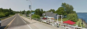
LANARK COUNTY’S SOUTHERN GATEWAY
Rideau Ferry has always been a stopping point. Forming a narrow point on the Rideau lakes system the site was first used by the Algonquins as a crossing and that tradition was continued as the first European settlers to Lanark County trekked northward from Brockville and today, as a picturesque rest stop along the Rideau Canal system.
Legendary Rideau Ferry Map
Brockville to Perth Settlers Trail
As central and western Lanark County was surveyed and opened up for settlement in the 1810’s, settlers, including War of 1812 veterans, trickled northwards to the Perth area and Rideau Ferry is where they originally crossed, risking life and supplies on log rafts that were oared across the narrows. A log corduroy road north to Perth had to be blazed through the hills and swampland.
Oliver’s Ferry
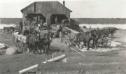
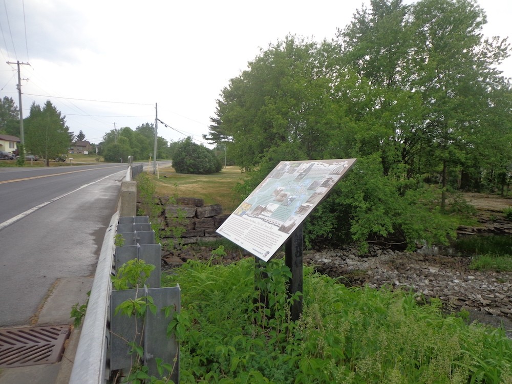
Originally named, Oliver’s Landing after John Oliver who set up his famous raft to ferry commuters across the narrows. Two of the more interesting characters along the route, Oliver and his son were known as prickly fellows, remembered today as much the legend of the vanished customers as their role in operating this crucial transportation link. Eventually the need for a more practical crossing method led to the first wooden bridge being built in 1874. This bridge was replaced by a two span iron swing-bridge in 1896. After a tank truck fell through the bridge in the 1960s the current six-span arch-bridge was erected and is in use today.
Industry to Recreation
Oliver’s Ferry, later known as Rideau Centre and finally Rideau Ferry, had a thriving economy in the late 1800’s, included lumber and saw mills, trapping, maple syrup production, a stone mason, dairy farming, and a cheese factory to name a few. While roads and rails diminished the commercial importance of the Rideau Canal by the second half of the 19th Century, Rideau Ferry became a recreational hub as summer cottages and homes were established along the shore and many of those same families continue to enjoy this area.
The Rideau Ferry Inn
Nothing epitomizes Rideau Ferry’s golden years like the Rideau Ferry Inn. Starting as the Coutts House, a three storey summer hotel, it was purchased by Doug Wallace, rebuilt and renamed in 1947. A favourite spot for weddings it was best known for its Saturday night dances bringing in bands such as The Staccatos, The Digratos (a local house band from Smiths Falls), The Five D, The Townsmen, The Esquires and The Continentals featuring Dennis Staples, who would later become mayor of Smiths Falls, on lead guitar. The Inn changed owners in subsequent years and sadly burned to the ground February 1986. The CCs on the Rideau restaurant occupies that site today. Memories of summer nights dancing to the sounds at the Rideau Ferry Inn and the Antler Lodge still linger in the stories of local residents.
Rideau Ferry Regatta
One of Canada’s largest vintage race boat regattas is held every second summer (odd years) in August. Hosted by the Rideau Ferry Yacht Club, this event welcomes boating enthusiasts of all ages to attend this award winning display of vintage race boats. The first regatta was held in 1897 when canoes, skiffs and steam yachts were fancily decorated, “paddles and oars painted and varnished, oarlocks greased, engines overhauled and oilers filled, coal bunkers packed with the best steam coal, and brass-work polished until it shone as bright as the sun itself.” By the 1920’s and 30’s up to 4,000 people attended the one day event in the village of fewer than 100 people. In the early 50’s many of the local boat builders and racing enthusiasts were well into the racing scene and the regatta continued as a landmark event of the Rideau Canal.
Rideau Ferry Yacht Club Conservation Area
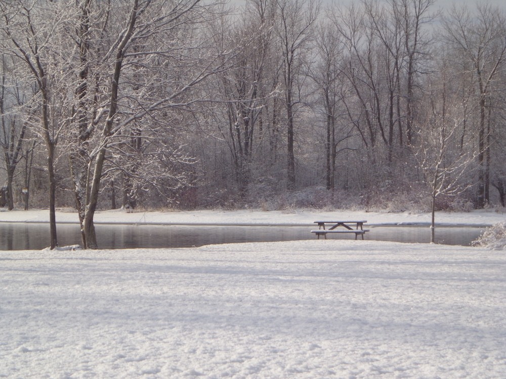
This ten acre day use recreation area was donated to the Rideau Valley Conservation Authority in 1976 by the Rideau Ferry Yacht Club, with the condition that the Club be allowed to use the site for their regatta. The beach, public boat launch and picnic area have attracted families for generations.
Rideau Ferry Today
Today, Rideau Ferry is a picturesque, vibrant rest stop along the Rideau Canal system for travelers by boat or roadway. We invite you to enjoy our village and visit our eateries, the general store, marina and discover places like the intriguing Rideau Ferry Conservation Area, with its beach and natural shoreline along the north shore of Lower Rideau Lake.


Port Elmsley was first named Barbadoes after the birthplace of Samuel Weatherhand, son-in-law to Benedict Arnold.
More than 13,000 acres were granted to the famous General for his defection to the British army. Weatherhead saw great potential in Port Elmsley and began the industrial growth of the area. At some point Barbadoes was renamed Pike’s Falls after the river that ran through the area, which is known as the Tay River today.
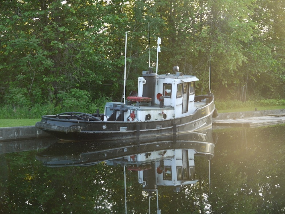
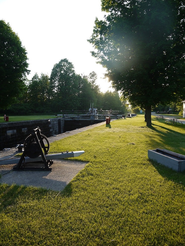
By mid-to late-century, the village boasted two hotels, three stores, two blacksmiths shops, two churches, a cooperage, a post office, a school, a railway station, a Town Hall, and several mills. With the development of the town of Perth it made sense to invest in a canal to transport goods and travelers up the river to Perth. The Tay Navigation Company was formed and five locks were built to help barges maneuver the rapids, evidence, of which, remain today.
With the building of the Rideau Canal, the little locks in Port Elmsley were left to deteriorate as a newer canal was built at Beveridges Bay providing a more direct route to Perth.
Today, Port Elmsley is a quaint village as vehicles travel between Perth and Smiths Falls and is the location of our municipal office and the North Elmsley Public School. The famous Drive-In still operates drawing the curious from as far away as Ottawa to experience this phenomenon from days gone by. We invite you to enjoy our picturesque village that envelopes the Tay River and discover our historic sites and buildings.
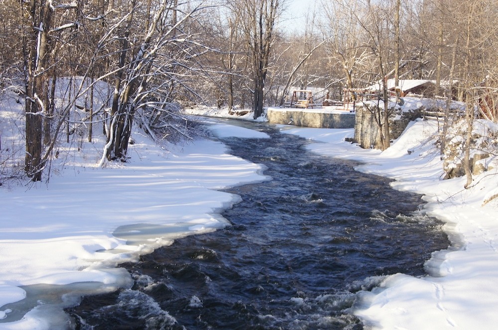


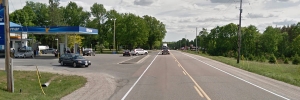
Innisville is situated on Provincial Highway 7 where it straddles the Mississippi River, half way between Perth and Carleton Place.
Innisville was originally named Freer’s Falls or Freer’s Rapids after Captain Noah Freer, a veteran of the War of 1812 who received a deed from the Crown in 1821 for all of Lot 20. The village was later named Ennisville after James Ennis who had the first mill there. Ennis would come to Canada in the spring, work the land, and return to Ireland for the winter. When the post office opened in 1851 a clerical error resulted in the community being called Innisville. The error was never corrected.

Innisville was a mill town with a huge dam an active woollen mill, sawmills, shingle mills, two flour mills and a grist mill. As well there were a couple of taverns, a hotel (which housed the general store and post office), blacksmiths, cooper and shoe shops, a school and at least one church and community hall. Eventually the mills disappeared and the village became quite a resort town. Some of the original cottages are still in use.
In 1959, the Mississippi Lake Migratory Bird Sanctuary Wildlife Area was established to protect staging waterfowl before becoming Mississippi Lake National Wildlife Area in 1971. It covers an area of 307 hectares located within the wetlands of McEwen Bay, where water streams in from the Mississippi River. The small bay is one of the few natural areas left on the Mississippi Lake shoreline. Muddy silt and debris support rich stands of wild rice, cattail and other plants, well sheltered by a peninsula and island at the mouth of the bay. The bay that collects the river silt provides lush stands of aquatic plants that feed thousands of migrating ducks each autumn.
Because of its location Innisville has always been a hub of activity. Its general store, LCBO outlet and gas station carry all the necessities. There is a MTO roadside park that provides a tranquil place for Highway 7 travelers to stop, eat and stretch their legs. Law and Orders, a popular restaurant, proudly boasts of the “Rhippo Challenge,” a food eating contest that very few participants have won.
We invite you to stop by the River and see if you can spot the pickerel making their way upstream or enjoy a cooling picnic at the roadside park. It is always a welcomed excuse to stretch your legs.
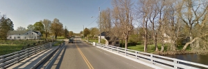
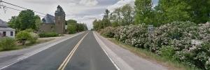
Tucked away among the lush Lanark County landscape is the hamlet of Ferguson’s Falls on County Road 15. Established along the Mississippi River, the hamlet quietly greets commuters on their destinations. There is no record of any falls however the rapids necessitated a portage when river travel was the main method of transportation. Today a modern bridge spans the river unassumingly.
Some of the names of the earliest settlers (such as Hollinger, Gray, Sheppard, Command, Quinn, Bedard and more) can still be found scattered around Drummond/North Elmsley and those found in the Ferguson’s Falls area are no exception. Jacob Hollinger served in His Majesty’s Regiment of Watteville and brought his wife Therese to this land. They struggled to farm and after 9 years he passed away leaving his wife and 9 children. Such was the hard life of the early settlers but Jacob’s descendants made the best of it and set down roots that would last for generations.
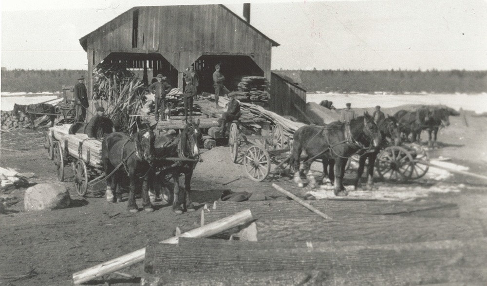
Originally known as Millford, Ferguson’s Falls, named for a Captain George Ferguson was a bustling hive of activity with a sawmill, grist mill, tannery, three hotels, two stores, a post office, a school house, a wagonmaker and a shoemaker and a church. The lumber industry was a lucrative business for Ferguson’s Falls and log drives were a yearly event with a stop-over in the village as the logs headed to Carleton Place sawmills. A lovely log building still stands as a testament of those days. Back then it was called the ‘Stumble Inn’ and it welcomed the weary lumberjacks as it does modern travelers today.
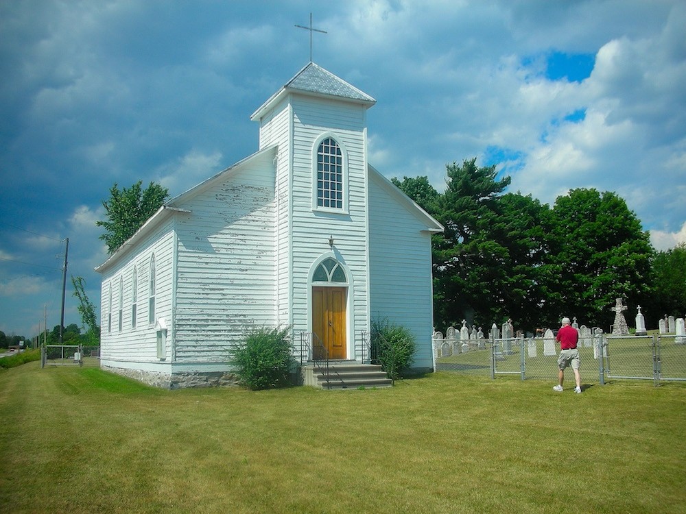
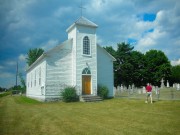
Today, St. Patrick’s Church gracefully adorns the roadside. Built in 1856 of wood clapboard, it is still used for the occasional service. The cemetery is a record of the Irish immigrants and a genealogist’s paradise. If you fancy a paddle a new dock has been added to the shoreline by the bridge and the Mississippi River is an exciting and rewarding trip for any boating enthusiast.
We invite you to take a tour of our countryside or treat yourself to some artwork created by one of the several artisans in the area. Be sure to stop in at Temples Sugar Bush, one of the famous Lanark County Maple Tour participants, where you will be treated to some of Lanark County’s finest maple products.